

Updated July 31, 2026, from Colorado Parks and Wildlife’s closure tracker. This list changes almost daily — two new rivers were added the morning I wrote this.
I just got back from a trip to Colorado, and I want to tell you what’s actually happening out there before you book anything.
The short version: it’s bad. Not “the fishing is slow” bad. It’s “the river isn’t there anymore” bad.
What I found
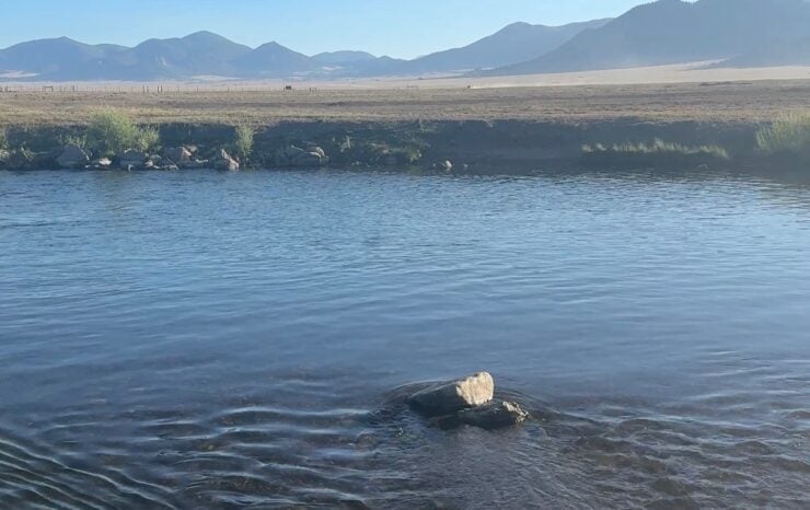
I went out planning to fish the Dream Stream and other spots I remember from my first days fly fishing 20 years ago. If you haven’t fished it, that’s the stretch of the South Platte between Spinney Mountain Dam and the inlet of Eleven Mile Reservoir, and it’s one of the more famous stretches of trout water in the state. Big fish move up out of the reservoir into it. People plan whole trips around this part of the river.
I got there early. I’m talking first light, which is when you fish in July anyway. And it was already low and already getting warm. Wasn’t quite 60+ at 6am, but wouldn’t take long to get there either.
My brother and I fished it anyway for a few hours and managed only a few bites before we threw in the towel. Most of the trout are holding in deep fast pockets or have moved to the lake below. It’s not worth the drive.
CPW made it official on July 29, a few days later. The Dream Stream is now under a voluntary afternoon closure, with flows running 94 cfs against a historical average of 190, and daily highs over 73 degrees.
We also had a stay booked at the Broadmoor’s fishing camp, and that got canceled on us because the Tarryall was nearly dry. Not low. Nearly dry. When a property that exists to put people on a river tells you it’s not fishable, that tells you everything about the water year.
Here’s what did fish: Cheesman Canyon, Eleven Mile Canyon, and the Big Thompson below Lake Estes. That was it. Everything else I looked at was either closed, too warm, or too skinny to bother with.
The pattern that explains this whole year
Look at those three waters again. Cheesman Canyon is below Cheesman Reservoir. Eleven Mile Canyon is below Eleven Mile Dam. The Big Thompson is below Lake Estes. All three are canyon tailwaters, and all three are pulling water off the bottom of a deep reservoir.
Bottom-release water comes out cold no matter what the air is doing. Then it runs through a shaded, narrow canyon where it doesn’t have much chance to warm up. That’s why those stretches held up while everything around them fell apart.
Now look at the Dream Stream. It’s technically a tailwater too. It sits right below Spinney Mountain Dam. But it runs through open meadow, wide and shallow, full sun on it all day. Same river system, same reservoir releases, completely different outcome. It’s closed and Eleven Mile Canyon isn’t.
That’s the thing to take away. In a year like this, “tailwater” isn’t the answer by itself. Deep release plus canyon plus shade is the answer. If any of those three are missing, the water is probably too warm.
The reason all of this is happening is simple and it isn’t going to fix itself before fall. There was almost no snowpack this past winter, and there’s been no meaningful rain since. There’s no water in the bank. Every river in the state is spending money it doesn’t have.
Voluntary vs. mandatory — know the difference
Most of what follows is a voluntary closure. That means CPW is asking, not enforcing. Nobody’s writing tickets. There’s no sign at every pullout.
I’ll be blunt about this. You can go fish a voluntary closure and nothing will happen to you. You’d just be killing fish in the worst water year in a generation so you could get a photo. Every angler who ignores these pushes the state closer to making them mandatory, and then it’s tickets and it’s everybody’s problem.
A handful of these are already mandatory — Yampa River below Stagecoach, Wahatoya, and the low-water park closures. Those carry consequences.
Most of the river closures run noon to midnight. Water is coldest right before dawn and heats all day. Fishing the morning and getting off the water by lunch gives fish the overnight window to recover. Some rivers are bad enough that CPW went to full-day closures instead.
Why 70 degrees is the line
Cold water holds more oxygen than warm water. As a river heats up, a trout’s oxygen supply drops at the exact moment its metabolism speeds up and needs more of it. The fish is already in the red before you ever put a hook in it.
Then you fight it. It goes anaerobic and loads its blood with lactic acid. In 55-degree water it flushes that and swims off fine. Above 70, a lot of them don’t. They kick out of your hand looking healthy and die a few hours later somewhere you’ll never see.
That’s the part people don’t get. Your release looked perfect. The fish was dead by dinner.
Trout also stop eating as water climbs toward 70, so the fishing gets worse anyway. There’s no version of hot-water trout fishing that works out for anybody.
Every closure on CPW’s list right now
Northwest
- Colorado River — Full-day voluntary, Red Dirt Creek down to the Highway 13 bridge in Rifle. Temps consistently over 71.
- Colorado River, Grand County — New as of July 31. Noon to midnight, Windy Gap Dam down to the Williams Fork confluence near Parshall. Includes Windy Gap, Hot Sulphur Springs, Byers Canyon, and the CPW State Wildlife Area below Byers Canyon.
- Fraser River — New as of July 31. Noon to midnight, County Road 8 in Fraser down to the Colorado confluence outside Granby. Includes Fraser Flats, Fraser River Canyon, and the public water in Granby.
- Eagle River — Full-day voluntary, Lake Creek in Edwards down to the Colorado confluence. Peaking at 77 degrees in Gypsum and 74.5 in Wolcott.
- Crystal River — Full-day voluntary, mile marker 64 on Highway 133 down to the Roaring Fork confluence. Running under 10% of average.
- Roaring Fork River — Noon to midnight, Highway 133 bridge in Carbondale down to the Colorado confluence. This is the lower river only. The upper Fork stays cooler and is open.
- Elk River — Full-day voluntary near Steamboat, Christina State Wildlife Area down to the Yampa confluence.
- Yampa River below Stagecoach — Mandatory full-day closure on the tailwater stretch.
- Yampa River, Sarvis Creek SWA — Full-day voluntary, top of the SWA down through the BLM stretch, roughly 1.7 to 3.3 miles below Stagecoach dam.
- Yampa River, Chuck Lewis SWA — Full-day voluntary, upstream boundary of the SWA to the west edge of Steamboat Springs.
- White River, Rio Blanco County — Noon to midnight on the North Fork and South Fork from the White River National Forest boundary to their confluence, and on the main White River down to County Road 5.
- Yampa River State Park — Low water warning. Downstream travel not recommended, and using the river bottom or bank on private ground can get you a trespassing charge.
- Vega State Park — Early Settlers and Island boat ramps closed for the season.
- Sylvan Lake State Park — Campground water supply is critically low. Spigots, showers and flush toilets are shut off. Fill your tanks before you get there.
Southwest
- Gunnison River — Noon to midnight, North Fork confluence at Pleasure Park down to Highway 65.
- Lake Fork of the Gunnison — Noon to midnight below Lake San Cristobal.
- Animas River — Noon to midnight through Durango, 32nd Street down to Rivera Bridge.
- San Juan River — Noon to midnight through Pagosa Springs, the Highway 160/84 intersection down to Yamaguichi Park.
- Dolores River — Noon to midnight below McPhee Dam to Bradfield Bridge. Running 5 cfs, and there’s Ferris Fire closure overlap out there too.
- Rio Grande — Noon to midnight, Rio Grande Reservoir Dam down to the Rio Grande Canal. Hitting 73.
- Rio Grande, South Fork — Noon to midnight, Big Meadows Reservoir Dam to the main stem. Hitting 75.
- Conejos River — Noon to midnight, below Platoro Reservoir to Broyles Bridge at County Road D.5.
- Tomichi Creek — Noon to midnight below Sargents. Hitting 75.
- Cochetopa Creek — Noon to midnight below the La Garita Wilderness boundary. Hitting 75.
- Mancos State Park — Jackson Gulch boat ramp closed for the season. Hand-launched only, and motors need an inspection.
- Paonia State Park — Boat ramp closed for the rest of the boating season. Hand-launched still allowed.
- Mountain Home Reservoir SWA — Voluntary fish salvage. Being drained for irrigation and the ramp will be unusable soon.
Northeast / Front Range
- South Platte River (Dream Stream) — Noon to midnight, Eleven Mile Reservoir inlet up to Spinney Mountain Dam. 94 cfs against an average of 190, over 73 degrees.
- South Platte River — Noon to midnight, Spinney Mountain Reservoir inlet up to the Middle/South Fork confluence. Under 10 cfs against an average of 170.
- Middle Fork South Platte — Noon to midnight, South Fork confluence up to Highway 285. Under 10 cfs against an average of 110.
- South Fork South Platte — Noon to midnight, Middle Fork confluence up to Highway 285. Under 10 cfs against an average of 40.
- Clear Creek — Noon to midnight, Vanover Park in Golden up to the Tunnel 1 Trailhead. Around 80 cfs against an average of 240, and over 73 degrees.
- Spinney Mountain State Park — Low water warning. North ramp is closed to trailered launching after sunset. Hand-launched and motorized still fine.
- Barr Lake State Park — Ramps closed for the rest of the boating season. Hand-launched allowed.
- Boyd Lake State Park — Closed to boating for the rest of 2026. Hand-launched and swimming still allowed.
- Timnath Reservoir — Voluntary fish salvage. Bag and possession limits removed, permits waived. Shore and non-motorized only.
- Douglas Reservoir SWA — Voluntary fish salvage, being drawn down for irrigation.
Southeast
- Two Buttes Reservoir — Dried up completely. It’s wildlife habitat now.
- Wahatoya SWA — Mandatory. Salvage is finished and the reservoir is closed for the season. Daigre Reservoir is still open.
- Wertz Pond near Karney SWA — Drawn down, fishery is gone, no more stocking planned.
- Nee Noshe Reservoir — Voluntary fish salvage. Size, bag and possession limits suspended until it’s lifted.
- John Martin Reservoir State Park — West ramp closed to trailered boats. Small craft can use the East ramp. Big boats shouldn’t try.
- Clear Creek Reservoir — Ramp closed. Shore fishing and hand launching continue.
So where do you actually go?
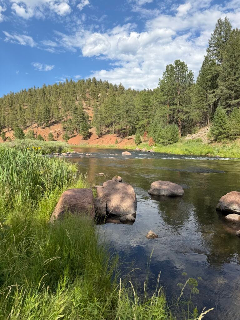
I’m not writing this to talk you out of a Colorado trip. There’s over 6,000 miles of stream and 1,300-plus lakes in that state, and the closures cover a small fraction of it. You just have to change your plan.
Go up. Elevation is the whole answer. High-country creeks and alpine lakes sit close to what snowmelt there is, in cool air, and they don’t care what’s happening down in the valleys. You’re hiking, and you’re catching smaller fish. Take the trade.
Fish deep-release canyon tailwaters. This is what worked for me. Cheesman Canyon and Eleven Mile Canyon fished. The Big Thompson below Lake Estes fished. Find the same setup elsewhere and it’ll probably hold up. Just don’t assume every tailwater qualifies — the Dream Stream is proof it doesn’t.
Switch species. This is the pivot nobody wants to make. Bass, walleye, pike, wipers and panfish are having a fine summer, because warm water is where they live. If your whole plan is trout-or-nothing and the trout water is closed, you’re passing up a lot of fish out of habit.
Fish the morning and go home. On rivers with afternoon closures, mornings are open and they’re also the best fishing of the day. Be there at first light, fish until 11, go get lunch. That’s not a compromise, that’s how you’d fish a hot river anyway.
Watch the salvage waters. Several reservoirs have suspended bag limits because the fish are going to die when the water goes. Timnath and Nee Noshe are both open with limits waived. Nobody feels great about it, but those fish aren’t making it either way.
If you fish, fish it right
Carry a thermometer. A stream thermometer costs less than a box of flies. Check the water before your first cast. At 70 or above, go somewhere else. This is the single most useful thing you can do and almost nobody does it.
Land them fast. Heavier tippet than you’d normally run, more pressure, shorter fight. Playing a fish to exhaustion for a delicate presentation is the worst thing you can do right now.
Keep them wet. Unhook in the water. If you can’t do that, at least don’t lift the fish out.
Skip the picture. CPW is straight-up asking anglers to stop with the hero shots this summer. If you have to, wet your hands, hold it over the water, one photo, done.
Check before you go
CPW keeps a live 2026 Weather and Drought Closures tracker, and it moves fast. Two rivers got added the day I wrote this. What’s on this page is accurate as of July 31 and it will be out of date at some point.
Before you drive anywhere, pull up the tracker on the CPW site and check the current list. Then call a fly shop in the town you’re headed to. A shop that’s on the water every day will tell you things a spreadsheet won’t — which stretches are actually fishing, what the dawn temps are doing, and where they’d go on their own day off.
It’s a rough year out there. It’s not a lost one. Just go in with your eyes open, and be willing to fish something other than what you drove out to fish.


Add comment